Categories
Save Face Save Time

Your Technology Guide for Geospatial Asset Collection

Geospatial technologies increasingly allow engineers and experts to evaluate assets quickly and accurately. Since the Department of Labor introduced geospatial guidelines for professionals in 2010, new methods and approaches have emerged with promising results.

Explore these technologies and their diverse applications below. Learn how advanced firms like PILLAR can help you evaluate assets, collect data, and improve infrastructure with these various geospatial tools.

Static LiDAR

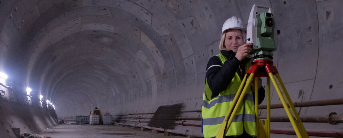
Collecting assets inside buildings, through intersections, on bridges, and on the ground—Static LiDAR (Light Detection and Ranging) measures and records asset data at a precise, granular level. The efficiency and methodology of Static LiDAR provide increased clarity for more complete and valuable data.

Since the information stored details your assets accurately, Static LiDAR applies best for transportation and construction applications, improving asset insights and decision-making for operations and maintenance planning.

Mobile LiDAR

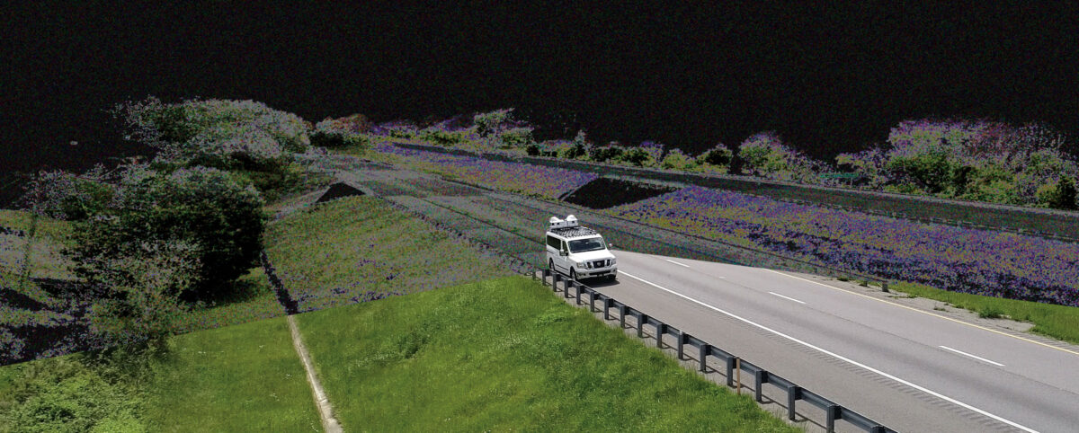
Mobile LiDAR scans roadways and other infrastructure assets with extreme accuracy and cost-efficiency. With a vehicle traversing highways, roads, and bridges, Mobile LiDAR provides detailed data on elevation, pavement conditions, guardrails, road signs and more:

  • Street and highway conditions
  • Landscape and transit elevation
  • On-the-ground data
  • Bridges, tunnels, slopes, and fences

Transportation and construction managers find great utility in this powerful mapping method, covering up to 50 miles of right-of-way every day.

Aerial Collection

Using planes and helicopters, aerial collection captures exansive plots of land by scanning and storing data without street-level detail.

Helpfully, anyone can access aerial collection data in their state since each makes this information public. While it is less detailed than LiDAR data (which most states do not publish), this format is used across industries:

  • Mining
  • Gas and Oil
  • Agriculture and Forestry
  • Infrastructure and Utilities
  • Emergency and Disaster
  • Construction Sites
  • Corridor Mapping

When you use this broad data in combination with sharp LiDAR collection methods, you’ll benefit from a global and granular assessment of your assets.

Drone Collection

Data on some assets can by difficult to collect. In some cases, data collection would block accessibility to the asset itself, present a safety issue or is simply inaccessible.. Drone collection offers a way for companies to still collect miles of asset data and related functions in the following industries:

  • Mining
  • Gas and Oil
  • Agriculture and Forestry
  • Infrastructure and Utilities
  • Emergency and Disaster

Speed through Asset Collection with PILLAR (and Save)

Committed to client safety and satisfaction, PILLAR provides quick, quality data to infrastructure professionals, by tailoring the data collection solutions and recommendations for public project improvements. Our meticulous approach promises accuracy and efficiency, and our extensive expertise means clients save time and money through our proven asset management process.

Contact PILLAR at info@pillaroma.com or (276) 223-0500 to leverage our advanced technologies and optimize your operations and maintenance plans.

Categories
Save Face Save Money Save Time

Why You Need to Invest in Pavement Preservation

Pavement Preservation is a set of cost-effective treatments that are typically applied on pavements at their early stages and are relatively in good condition. Pavement Preservation allows transportation agencies to treat more lane miles with less cost, while lengthening the pavement’s service life. Transportation agencies adopting Pavement Preservation will extend the benefit of taxpayers’ dollars, among many other benefits.

Primary Benefits of Pavement Preservation

Transportation agencies are paying more attention to Pavement Preservation as their maintenance budgets get tighter each year. This led to the wide adoption of Pavement Preservation treatments within the agency’s operations and maintenance programs. Agencies adopting Pavement Preservation treatments record major benefits that include:

  • Improves the condition of pavements and investments
  • Remains cost-effective for service life and pavement performance
  • Quick application and reduces road user costs and closure times
  • Requires fewer resources and energy than reactive maintenance
  • Stops the future deterioration of the pavement under your watch

Arguments Against Pavement Preservation Just Don’t Fly

Despite significant benefits, there are some reasons cities and towns don’t invest in pavement preservation as much as reactive maintenance tasks.

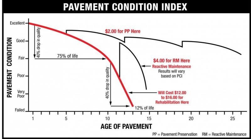
Civilians typically prefer all new pavement with new layers of either asphalt concrete or cement concrete. At the early stages of preservation treatment, pavement appears rough and messy until the treatments completely cure. To combat public outcry, engineers must continuously meet with civilians to educate them on the pavement preservation process. Engineers should demonstrate how reactive maintenance is more time-consuming and expensive, costing tax payers more money to fix damaged roads in the long run (see Figure 1).

The primary reason transportation agencies in cities and towns don’t invest in pavement preservation is due to a lack of expertise and knowledge on preservation treatments. With the variety of preservation treatments available, engineers don’t include the preservation treatments in their pavement management programs because they lack the know-how to choose the proper treatments for all road conditions.

Operations and maintenance professionals default to focusing only on damaged pavements, ignoring pavements that are in good condition. Asset management budgets get eaten up by reactive maintenance when they could invest in preserving good roads, therefore investing less in reactive maintenance over time.

Some have the misconception that preservation treatments are an unnecessary expense. In reality, the treatments are quick while costs stay at a minimum. Some agencies in rural areas fear that hiring contractors with pavement preservation expertise will be more costly than local professionals, however, including pavement preservation in pavement management programs will extend budgets and the service life of pavements.

Figure 1. (Source)

Partnering with PILLAR Pavement Management Engineers

Sometimes an organization doesn’t invest in pavement preservation due to a lack of expertise. There is a certain complexity to managing a network of roadways at different stages in their lifecycle that requires insightful data and a guiding hand.

PILLAR can play a role in assessing needs and making important maintenance decisions.

For example, PILLAR uses ratings to assess the condition of pavements, watching as the condition rating changes with time. This can be helpful to maintain a standard while getting the expertise needed for these numerous treatments.

Choosing the Right Pavement Preservation Treatments

When choosing treatments, PILLAR helps you map out roads, traffic volumes, and regions to make sure that roads are treated in line with the best treatment. There is a wide variety of possible preservation treatments that make the care and maintenance of each road extremely unique.

Every preservation plan is unique based on the special features of the roadway and pavements that make planning your preservation techniques somewhat complicated without a competent partner. PILLAR works with you to identify the condition of the road or pavement and then develop a series of interventions to lengthen the lifecycle of the road, save time, and conserve budgets. Some noteworthy and famous pavement preservation treatments that can be used include:

  • Crack Sealant
  • Slurry Seal
  • Chip Seal
  • Cape Seal
  • Microsurfacing (Latex)
  • THMACO

Find a Partner in Pavement Preservation and Asset Management

PILLAR is a unique firm. It’s the only asset management team devoted at its core with maximizing the lifecycle of your assets. By delivering asset data that informs operations and maintenance decisions at every step in the complex process, PILLAR strengthens your maintenance and preservation plans in ways that could really benefit your infrastructure asset management programs.

Contact PILLAR at info@pillaroma.com or (276) 223-0500 to start with the only asset management firm that merges industry expertise, next-gen technology, and public safety to bring you unparalleled data, service, and expertise.

Categories
Save Face Save Money Save Time

Hiring Operations & Maintenance Advisors is a Sound Investment.

Assessing and leveraging data on all infrastructure assets within your right-of-way for long term sustainability can be a challenge. As a result, it becomes even more difficult to achieve long term infrastructure goals. Operations & Maintenance advisors can be a highly effective resource in managing your assets and securing the proper funding you need for improving your assets.

PILLAR is the only asset management firm whose core business is dedicated to maximizing the lifecycles of your assets by collecting and delivering asset data that informs operations and maintenance decisions at every step of the process. PILLAR’s focus is holistic and goes beyond the typical pavements and bridges that include assets such as ditches, signs, markings, fence, etc. Optimal asset management includes all assets to give a much wider and inclusive perspective to account for all variables.

Know the Location of Your Assets

Pillar’s collection process combines old school approaches with cutting-edge technology to bring you a cost-effective way to collect massive amounts of inventory data quickly and accurately. Create digital 3-D representations of the right-of-way with PILLAR’s Mobile LiDAR Scanning that includes our Automated Feature Extraction System, extracting features almost as quickly as data is collected. At the same time, you’ll work with boots-on-the-ground maintenance professionals to go places machines and technology can’t reach.

Identify the Condition of Your Assets

PILLAR doesn’t just collect asset data; our professionals assess the data collected to justify the costs required to improve asset conditions. Experts use Condition Indices to measure Condition Rating Criteria for various asset types beyond pavements and bridges, such as pavement markings, guardrails, signs, slopes, fence, and tunnels. Using computer vision allows us to use Street Level Imagery from video stills to detect asset deficiencies. Our geospatial technologies provide in-depth point cloud analysis to give you a global view of the location and condition of your assets. Experienced maintenance staff also perform on-site field assessments and visual inspections.

Take control of Your Operations & Maintenance Plans

Unlike other firms, PILLAR advisors go beyond delivering asset data and go to work on planning strategies for your assets and the future. Data integration is seamless between databases as PILLAR works with numerous suites of geospatial software. You’ll receive solutions within many different contexts, including contract development, daily, weekly, and yearly work plans, bottom-up budgeting and estimating, and response plans in the case of an emergency.

Execute Your Plans with Expertise and Certainty

The PILLAR team not only helps develop your plans, we make sure you execute them. We can augment your staff to meet your program’s needs and oversee staff to ensure your asset management plans reach an optimal result. To fully see your plans through, our advisors can hire Operations and Maintenance managers to manage and control your budget, schedule, quality, as well as your incident, disaster, and weather response. Integration is seamless, coordinated, scheduled, and proactive.

Transform Your Operations & Maintenance Plans with PILLAR

Across the board, PILLAR advisors are a valued part of your team, working to inform you about your assets, offer data-driven decisions to secure proper funding, with in-the-field experience to hire and organize the staff necessary to carry out your plans so you don’t have to.

Stop guessing what to do with your Operations and Maintenance plans and be certain with PILLAR. Email us at info@pillaroma.com or call (276) 223-0500 to get started with the only asset management focused firm merging industry expertise, next-generation technologies, and commitment to public safety.

Categories
Save Face Save Time

Transforming Geospatial Data: The Power of Geomatics

Technology is revolutionizing and transforming geospatial data. Going far beyond your typical data point collection and measurements, we can use evolving geospatial tools such as LiDAR, GPS/GNSS, and remote sensing to collect comprehensive and multi-dimensional geographic data. This data is extracted and analyzed to make data-driven decisions in the development of transportation asset management plans. 


The incorporation of these technological tools has created some confusion in the geospatial industry causing the coining of a new term, Geomatics. Geomatics has entered our lexicon to cover the multiple ways and uses of the data derived from these geospatial tools by various disciplines.

Pillar uses these advancing technologies to yield enhanced efficiency and results. Read on to learn more.

The true and sometimes subtle differences between geospatial differences create confusion. Today, those differences grow even finer as mobile mapping, asset management, and unmanned aerial vehicles become integrated in daily operations.

Defining Geospatial: More than an object

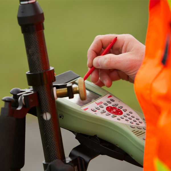
Surveying Device

Using the term geospatial indicates that an object or object set has a geographic component to it. Typically, this geographical component is identified in terms of coordinates (latitude, longitude, altitude). However, it can also relate to an addressed location such as a house number on a street in a specific city in a specific state or zip code. Most of the time the geographic component is attributed through global positioning system (GPS). However, satellite imagery or photogrammetry can be utilized to derive the geographic component.

Defining Geographic Information Systems (GIS): Controlling Ever-Growing Geospatial Data

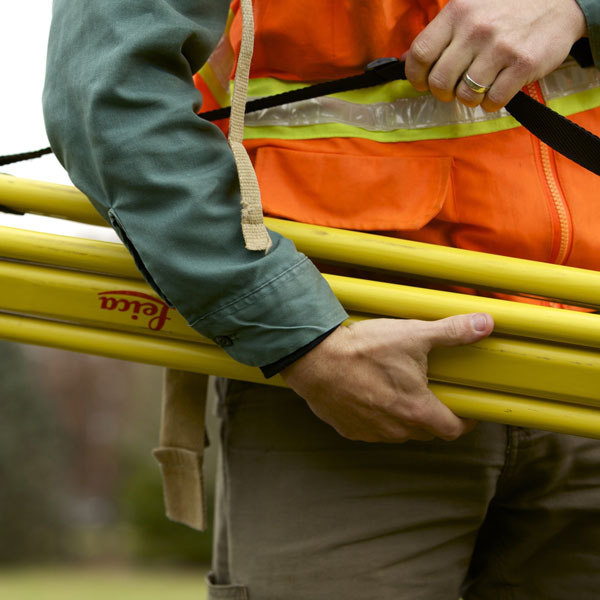
Surveying Device Folded

Geographic information systems (GIS) manage, store, and integrate geospatial data collected from:

  • Satellite imagery
  • Demographics
  • Statistics
  • Road networks
  • Historical maps
  • Investigation, etc.

The information systems cataloging these data points helps professionals manipulate, analyze, and map their geospatial data. Through GIS, you can view, analyze, and house multiple layers of information to perform various volumetric and area calculations, create maps, and perform various types of modeling.

Since geospatial data is ever-growing, GIS becomes an essential tool for the management of valuable data for project planning and improved efficiency of research. But, when one goes beyond the collection and storing of important geospatial data, they enter the multidisciplinary science of geomatics.

Defining Geomatics: Going Beyond Geospatial Data with Interdisciplinary Science

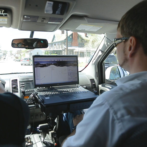
Pillar Mobile LiDAR Screen in Vehicle

Many people describe a wide selection of geography-relevant technology and disciplines as “geospatial.” However, “geomatics” involves more specifically the sciences of:

  • Surveying
  • LiDAR
  • Cartography
  • Satellite navigation
  • Photogrammetry
  • Mapping, etc.

While these are all excellent geospatial methods with formal procedures, geomatics also includes other sciences seemingly divorced from geo-inquiry such as:

  • Computer science
  • Mathematics
  • Engineering

To put it more simply, geomatics synthesizes spatial information with scientific application. It concerns the measurement of the Earth and technologies that help you act on that information. Geomatics goes beyond mere data to solve complex infrastructure problems with the latest technology.

Pillar is a dedicated transportation asset management firm focused on collecting, analyzing, and turning data into decisions for transportation infrastructure.

Our proprietary CAPE approach for asset management integrates geospatial data with geomatics to optimize and execute operations and maintenance plans for infrastructure organizations.

Asset Management Experts

PILLAR is the only asset management firm whose core business is dedicated to maximizing the lifecycles of your assets – delivering asset data that informs operations and maintenance decisions at every step of the process. We use your existing data to extend the life of your assets for roadways, bridges and tunnels. We assess data availability and accuracy to give you an operations and maintenance plan developed to optimize budgets and timelines.

At PILLAR, we’re ethically and completely committed to the safety and satisfaction of the public. We give unbiased and evidence-based recommendations and solutions for the improvement and maintenance of roadways.

Contact us at info@pillaroma.com or (276) 223-0500 to get started with the only asset management focused firm merging industry expertise, next-generation technologies, and commitment to public safety.

Categories
Save Lives Save Money Save Time

Pillar Partners With Rose-Hulman Ventures

Rose-Hulman Ventures recently featured PILLAR and reviewed our patented salinity measurement device, SAM. PILLAR President Mark Boenke, shares his expertise on how SAM will reduce harmful salt usage on public roads and highways. Boenke partnered with Rose-Hulman Ventures back in 2017 when PILLAR was trying to find the best materials to use for the SAM device that would not be damaged by the highly corrosive saltwater. SAM was first developed by Mark’s daughter, Bridget, as her high school senior year science fair project!

SAM is a salinity measurement device that reads the salt concentration, via electrical conductivity, in the water spraying off of the salt spreader’s back tire. If the salt concentration levels are too low to prevent the forming of black ice, the driver is notified to apply more salt. If concentration levels are adequate, the driver is notified that no additional salt is needed.

PILLAR hopes to bring SAM to the market by 2021. Be sure to check back in for updates on SAM’s release and all of PILLAR’s projects!

Read the full article.

Categories
Save Face Save Money Save Time

P3 Market Outlook for 2020 in USA & Canada | Inframation News

PILLAR’s Dan Dennis, Vice President of Public-Private Partnerships was quoted on the positive trend of risk allocation in the P3 model. 

Read the full article to see Dan’s comments on risk allocation.

Categories
Save Face Save Money Save Time

Delivering Maintenance Cost Efficiencies in P3/O&M Projects

If you are performing an outsourced O&M project, it is very likely you have a fixed budget based on your contract price. Your cash flow is known upfront, the day you sign the contract. As the Maintenance Manager, your job is to meet the contract performance requirements as efficiently as possible while meeting your budget. How do you do this? Simple: Spend resources wisely and efficiently. Basic planning can help you do this.

A typical example could be: The roadway shoulder has accumulated dirt, weeds, etc. in the longitudinal joints on a narrow shoulder next to a barrier wall. Simple enough to clean up, right? But the work area is three feet wide and adjacent to the left (high speed) lane on a 75-mph urban interstate. MOT requirements called for a full lane closure – in both directions.

What does this all mean? Before any work starts, you have already spent $2,800 for the two lane-closures. To save money and be efficient, how many other tasks can be done in that lane closure?

  • Burn out the roots with a propane-hot lance torch.
  • Seal the joints with hot or cold-pour asphalt joint sealer = no more weeds for five years.
  • Jet-vac all the drop inlets within the lane closure.
  • Install barrier-wall mounted delineators.
  • Repair any potholes or crack-seal the longitudinal joint
  • Sweep/vacuum the dust and debris.

These additional tasks will be required at some point. Why not do it all at once? The additional labor is minimal, and you likely have all the small tools; if not then rent them. By combining the activities, you have saved multiple lane closures and perhaps up to $10,000. This adds up.

This is basic preventive maintenance. And all it takes is – a little planning.

To learn more about how Pillar can help more efficiently manage your P3 project, contact Mark Boenke at mboenke@PillarOMA.com

Categories
Save Face Save Money Save Time

Artificial Intelligence (AI) in Transportation Asset Management

There have been numerous developments in recent years in the field of Artificial Intelligence (AI) that are transforming our daily lives. Among the most commonly recognized are self-driving vehicles and voice recognition devices such as Amazon’s Alexa.

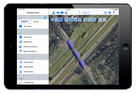
iPad showing screenshot

While perhaps not as flashy as having your virtual personal assistant, Pillar Operations & Maintenance Advisors is a leader in the important integration of AI into the world of transportation asset management.

Using AI, Pillar can collect and assess vastly larger datasets in less time with fewer resources than ever before. What once took months to identify, collect and assess transportation assets can now take as little as three days.*

Why does this matter?

Pillar can help clients make cost-effective, data-driven transportation maintenance decisions and plans based on actual priorities derived from clear and comprehensive data. This data results in safer, better-maintained roadways for the traveling public.

For example, we gathered guardrail length inventory by assessing its condition in accordance to the Maintenance Rating Program for a state Department of Transportation. This data enabled the state DOT to develop a maintenance plan, allocate the workforce and secure a budget for the project.

Here’s a more in-depth look at how AI is being used in Pillar’s proprietary CAPE approach to transportation asset management:

Collection – We are using AI to help identify assets for gathering a database of inventory. To do this, we have trained algorithms that scan our imagery and point cloud data to locate assets. We also utilize a system that automatically extracts these features into a legible format. The two systems provide a level of redundancy and quality assurance that is integrated with your GIS. Together, these systems create a sophisticated level of detail that was previously unattainable.

Assessment – AI helps us assess the condition of transportation assets by using algorithms to identify items such as a leaning sign, clogged ditch, and much more.

Planning – AI is an extremely useful aid in conducting research. By combining “big data” with the inventory collection and assessment data, we developed algorithms to build predictive analytics that make proactive maintenance possible.

Execution – We use AI to monitor operations to ensure quality standards are met. Further, the data stays current as tasks and projects are completed.

*Timeliness will vary from project to project based on size and number of assets collected.

Categories
Save Face Save Money Save Time

How Outsourcing with a P3 Project Makes Good Business Sense

What is outsourcing?

Outsourcing is simply using contractors to do things traditionally done by in-house staff.

In the P3 space, virtually the entire project is outsourced, by definition. In a traditional, publicly owned and operated roadway, the Owner (DOT/Ministry, etc.) provides operations and maintenance for the roadway with in-house staff, trucks, equipment and materials. Similarly, a facility such as a hospital, manufacturing facility, port or other large fixed asset will have maintenance staff and operational support.

What are the benefits?

In a word, “Efficiency.” But how? For one, you get more efficient use of your people resources.

Good workers generally want to do a good job – finish it properly and move to the next task. Contractors and mechanics know this. If they have a lump-sum price to replace your HVAC system, they will get it done quickly and efficiently and move on to the next job. If you pay all of your subs a T&M rate, you won’t get this benefit. If all your maintenance personnel are hourly in-house staff, you are essentially paying them a T&M rate. They are not motivated to get the job done faster.

What’s so special about specialists?

With today’s technology and ever advancing and inter-related systems, it is much more difficult to hire, train and keep a “jack-of-all-trades” maintenance staff on hand. It is more efficient, safer, faster and cheaper to utilize a team of highly trained, on-call specialists. With new technologies on the horizon, you may not even need to “fly in” the technician.

Get better use of your equipment resources

  • Don’t let it sit idle: If the machine sits in the yard most of the time, you don’t need to own it. Maybe it seemed to make sense when you bought it, but you are not in the business of amassing a fleet of equipment that sits most of the time. Instead, try subcontracting, renting or leasing it. Construction companies know this and have a fleet of lowboys working every night to get idle equipment to the site of a (paying) job.
  • Paid-for equipment is not free: Maybe that motor grader sitting on your property is paid for. But if it’s not being used, that’s a $150,000 pile of cash sitting in your yard that could get another thousand feet of ditch cleaned or 200 potholes filled. At a minimum, share it or make it available to another location.

Finally, we mention profit. The profit motive drives efficiency and productivity. Although it can be a dirty word sometimes, the profit motive – coupled with performance standards – will undeniably drive innovation and ultimately result in lower costs.

About PILLAR, Inc.
PILLAR is a multi-discipline firm focused on collecting, analyzing, and turning data into efficient and effective strategies for operating and maintaining roadways, bridges, tunnels, and other forms of infrastructure. We are a trusted partner that DOTs, municipalities, and P3 stakeholders rely on for expertise in safely managing roadway infrastructure in a fiscally sound and responsible manner.”

Categories
Save Face Save Time

The Case for Pavement Management

Why is pavement management important?

The nation’s road system represents an asset valued at more than $2.4 trillion. Nearly 90% of passenger-miles traveled and 60% of the nations’ total freight is transported via the nation’s highway system. There is no doubt, it is an asset worthy of substantial investment for the sake of our economy and the safety of our citizens.

Two constant elements unrelentingly diminish pavement’s value and cost the nation billions of dollars every year: traffic loads and environmental conditions.

The budgets allocated for the construction, repair and ongoing maintenance of pavement grow increasingly tighter. As a result, it has become obvious that relying solely on traditional experience-based maintenance and repair (M&R) techniques is not sufficient. We have the tools and knowledge to proactively manage the maintenance of our nation’s highways, taking into consideration a number of factors such as life cycle cost analysis, timing of projects, prioritization and optimization, as well as the prediction of pavement performance. This modern approach to the pavement management process takes all these factors into consideration to develop a proactive, cost-efficient approach to protecting and preserving the valuable asset our national highway systems represents.

In his wonderfully informative and helpful book, “Pavement Management for Airports, Roads, and Parking Lots,” M.Y. Shahin describes pavement management as “systematic, consistent method for selecting M & R needs and determining priorities and the optimal time of repair by predicting future pavement condition.”

The importance of maintenance timing is illustrated nicely in the following figure from the book:

pavement management graph

The figure clearly shows that conducting M &R before the sharp deterioration of the asset results in significant savings on repair costs. These financial savings are in addition to avoiding long roadway closures, detours and traffic delays.

The pavement management process consists of the following steps (each of which will be discussed further in another Pillar Talk column):

  1. Pavement inventory
  2. Pavement inspection and assessment
  3. Pavement condition prediction and analysis

Every dollar spent on thoroughfares is an investment in the economy and public good. Indeed, pavement management is a valuable tool in ensuring taxpayers that their investment (tax dollars) are providing them with a safe, accessible, sustainable, and long-lasting network of roadways.