Categories
Save Face Save Lives Save Money Save Time

Meet the PILLAR Team Online and In-Person at Upcoming Events

Over the next few months, members of the PILLAR team will be on the road at various tradeshows and conferences. It’s the perfect opportunity to learn more about the company’s approach to infrastructure asset management and how it can help organizations save time, save money, and save lives.

Our unique approach merges technology with specialist expertise to maximize efforts, justify budgets, and reduce risk, thereby delivering greater sustainability and longevity of your transportation assets.

The PILLAR team would love to share more information with you. Make sure to say hello if you see us in person or online at one of these upcoming events.

If you’d like to discuss ways to save time, money, lives, and face (by preventing public outcry in the case of a disaster), contact us to schedule a meeting during one of these events at info@pillaroma.com or (276) 223-0500.

Categories
PILLAR Talk

PILLAR Helps Maximize Your Transportation Infrastructure

Maintaining the integrity of your transportation infrastructure assets can be complex and overwhelming. But it doesn’t have to be. PILLAR is solely dedicated to maximizing the life of transportation infrastructure through our proven CAPE approach: collection, assessment, planning, and execution. There’s a reason we’re trusted by transportation departments all over the country: we deliver reliable inventory collection, assessment, and management services that save time, meet budgets, and extend asset life. 

Watch our video to learn more about how you can remove uncertainty and deliver greater resiliency and longevity to your assets.

Categories
Save Face Save Lives Save Money Save Time

Virginia State Highway Performance Ranking Leaps to #2 Nationally

The PILLAR Team congratulates the Virginia Department of Transportation for earning the nation’s #2 best highway performance ranking. Virginia operates the third-largest DOT network in the nation and handed in an impressive 19-position improvement in the 26th Annual Highway Report from the Reason Foundation.

Virginia moved up the ranks in several areas, including improving 24 positions for capital and bridge disbursements, improving 15 positions for maintenance disbursements, and improving 17 positions for urbanized area congestion.

Cost-effective Maintenance & Operations

Virginia’s highway system is considered one of the most cost-effective highway systems in the country.

“States with high ratings typically have better-than-average system conditions (good for road users) along with relatively low per-mile expenditures (good for taxpayers),” according to the Reason Foundation annual report.

PILLAR has been a trusted partner of VDOT for nearly 10 years, serving as its contractor for Statewide Maintenance Consulting Services.

“The PILLAR Team is proud to support VDOT in its continuous quest for excellence through best management practices and innovative transportation management solutions,” said PILLAR President Mark Boenke.

How PILLAR partners with VDOT

PILLAR supports VDOT in several ways, providing information that will save time, money, lives, and credibility.

A Penny Saved is A Penny Earned

PILLAR utilized its mobile LiDAR and conventional and traditional survey methods to gather dimensions on overhead signage that needed replacing in VDOT District 1. By defining accurate dimensions, PILLAR determined the existing support structure could be utilized for the new sign, saving significant time and money for VDOT.

Creating Efficiency from Field to Office

PILLAR georeferenced plan sheets to locate the position of pipes along the I-95 corridor in Caroline, Spotsylvania, and Stafford counties for VODT’s Fredericksburg District Office. This enabled VDOT field personnel to easily locate pipes when performing inspections. Ultimately, saving time and money.

Environmentally Friendly Asset Management Solutions 

PILLAR helped the VDOT Staunton District save $12.9 million in mitigation projects and nitrogen-credit purchases, also earning the district the Environmental Stewardship award. The efforts allowed VDOT to reallocate money to other critical needs throughout the district.

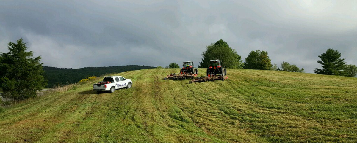
The project used an innovative approach. It took PILLAR’s LiDAR-based mapping for mowing management and helped save the district millions annually in converting interstate rights-of-way into pollinator habitats.

What PILLAR can do for you

What sets PILLAR apart is our CAPE approach.

That’s our Collection, Assessment, Planning, and Execution (CAPE) approach that intersects technology with our expertise to tailor asset management plans for program funding, public outcry, and improved services.

We advise state agencies and provide plans that avoid potential pitfalls and save money.

“Our staff augmentation helps improve knowledge and experience to achieve a high maintenance rating program (MRP) with average scores in the low-to-mid 90s,” Boenke said.

Contact PILLAR today to get started on improving your maintenance and performance rating.

Categories
Save Face Save Money Save Time

How to Calculate & Classify Mowable Area with LiDAR

Your agency has a lot of ground to cover. Literally. Municipalities and departments of transportation have acres and acres of land that need to be managed.

PILLAR can help assess the best way to tackle ground that might have to be mowed or best left unmowed and calculate the total mowable area and frequency or necessity of that upkeep.

This practice can help save your agency valuable cash, up to millions.

Mowing Frequency

Knowing what you need to maintain frequently and where to cut back can save millions in costs. Your agency will save in labor and equipment costs and heighten the safety of workers in high-traffic areas.

Certain areas benefit from a less frequent trim. Cutting tall grass and cutting back brush can improve visibility but may only have to be maintained once a year instead of cutting every few months.

The environmental benefits differ as well. If acreage is classified as an environmental benefit, your agency can receive credit toward mitigation and pollution reduction projects, such as pollinator or stormwater run-off programs.

When you contract with PILLAR, you’ll receive a full assessment of best practices.

How PILLAR Calculates & Classifies Mowable Area

PILLAR helps you get a better sense of what is needed for the land you manage.

We use image scanning and Mobile LiDAR, which can accurately inventory acreage that should be added to the total calculated mowable area. Additional access to land plats can help us determine if you can earn environmental stipends for mowing less frequently.

Our services also include an assessment of the terrain, so we can work with you to determine the types of equipment needed and the time and frequency required to maintain that acreage. That information also helps us parse and configure mowing patterns/swaths for full mows or partial mows.

After all the data is collected, we will work with your geospatial system of choice to integrate and normalize your mowing data.

The PILLAR team has more than 100 years of combined experience working with and for municipalities and departments of transportation. We know how to help classify environmental benefits and safety requirements needed to maintain your areas and keep the public safe.

Case Study

PILLAR was able to help Staunton earn $12.8 million in credits for pollution mitigation from our assessment of mowable acreage. Their practices earned them VDOT’s Staunton District’s Environmental Stewardship Award.

Learn how we can help you. Contact us today.

Categories
Save Face Save Lives

Endangered Bat Species and LiDAR: PILLAR Technology is Mapping Conservation Efforts

PILLAR works with departments of transportation, environmental, and engineering firms to better understand the condition of infrastructure in challenging environments. LiDAR (mobile light detection and ranging) is an advanced technology that goes beyond just providing detailed maps: the data can be used to influence critical decisions to protect critical wildlife habitats.

PILLAR’s recent project at a bridge in southwestern Virginia highlights the effectiveness of LiDAR for mapping conservation efforts and managing transportation infrastructure.

LiDAR Applied to Wildlife Conservation: A Case Study

Scientists learned that the endangered gray bat and the more common big brown bat, were using this man-made structure for roosting purposes, yet engineers needed to assess the bridge’s operating conditions and schedule routine maintenance. Gray bats are listed by the Virginia Department of Wildlife Resources (DWR) and the US Fish and Wildlife (USFWS) as endangered, and upwards of 10,000 gray bats find refuge in the bridge from April through October as a maternity roosting site.

A cluster of gray bats roosting under a southwestern Virginia bridge.

The Virginia Department of Transportation along with biologists from Stantec Consulting Services, entrusted PILLAR to accurately survey the bridge with noninvasive LiDAR technology and collect data on the structure, while also preserving the bats’ habitat and wellbeing. In approximately one hour, PILLAR engineers had safely completed their survey, and biologists studied about 200 gray bats in their natural habitat.   

Experts from PILLAR teamed with biologists from Stantec to survey the bridge accurately and quickly without disrupting the roosting areas of the gray and big brown bats.

A Positive Impact

Noninvasive and accurate, PILLAR’s approach using LiDAR and its proprietary Automated Feature Extraction System (AFES) safeguards sensitive ecosystems and wildlife habitats while collecting the required data. This data then helps officials develop environmentally sensitive approaches to infrastructure maintenance planning.

Contact us at info@pillaroma.com or (276) 223-0500 to discuss PILLAR’s mobile LiDAR solutions and how next-generation asset management technology can enhance your next survey project.

Categories
Save Lives Save Time

A New Tool for PILLAR Infrastructure Asset Management’s Services

For years, PILLAR has been helping municipalities and departments of transportation manage and inventory infrastructure assets like signs, guardrail footage, mowing acreage, trees, striping, ditches, sewers, overhead utilities, and more.

Now we’ve added a new tool that will enable our clients to manage, visualize and assess underground pipes, sewers and waterways safely and efficiently.

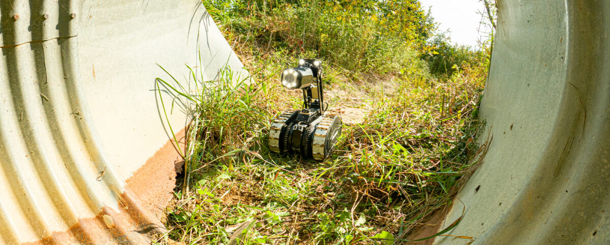
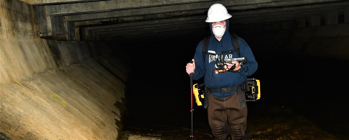
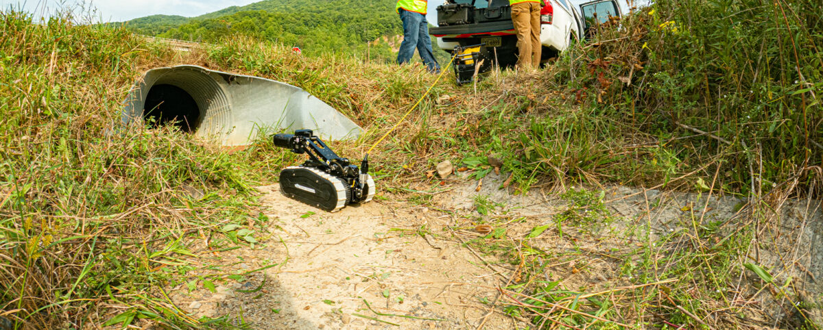
The DeepTrekker 340 L Pipe Crawler is the latest tool in PILLAR’s arsenal, adding another layer of geospatial detail that we are able to capture in addition to Mobile LiDAR and our other capabilities.

Rugged and mobile

The Pipe Crawler is a robotic, remotely guided platform submersible up to 164-feet with tether options up to over 1,300-feet. It is extremely portable, breaking down into two cases, and easily deployed and operated.

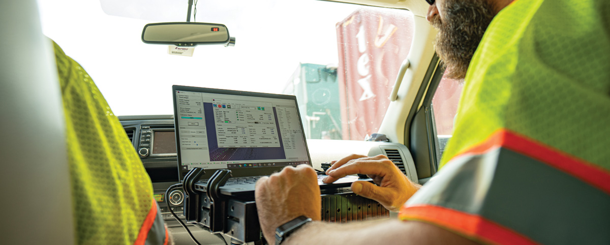
A video camera with tilt, pan, and zoom capabilities can be attached to the body of the Pipe Crawler, allowing up-close, internal inspection of pipes to assess their condition and look for potential flaws. PILLAR can integrate the data collected with your organization’s asset management database, and recorded video can be directly uploaded to the asset management software.

The Pipe Crawler runs on batteries, as does the hand-held controller, making it a truly portable option for inspecting underground pipes almost anywhere.

A safer option

With the Pipe Crawler, we can help you get places that wouldn’t be safe or accessible for humans, and we can deploy quickly in emergency situations. We can save you money because you don’t have to wait for contractors or multiple people to inspect a pipe. And we can save you time by starting data collection instantly rather than waiting for jet or pump trucks or dealing with unexpected terrain disruptions.

The Pipe Crawler is a rugged modular system that allows us to customize it for your particular application, with a variety of options for wheels, elevating arms and cameras.

Contact PILLAR today to find out how we can put the Pipe Crawler to work for you.

Categories
Save Face Save Money Save Time

Work Smarter by Aggregating and Normalizing Your Asset Data

Technology has made creating a geospatial inventory of transportation assets far more accessible than it used to be. However, this asset data may be accumulated from many different sources and may have been collected using disparate techniques and technology, resulting in data that is formatted differently.

The inability of different systems to talk to each other often means that municipalities and departments of transportation frequently resort to recollecting data they already have because of a siloed department structure. This is costly and limiting.

But PILLAR can solve this problem. We can aggregate and normalize data from many different sources (from paper to pdf to complex databases) and departments, giving your organization far greater flexibility and eliminating the need for costly recollection of data you already have.

Getting started

PILLAR will gather all the data files you have already collected, identify what technology generated the data, then audit it and identify a storage solution for optimal visualization for the end-user. We determine goals and help create visualization tools that provide decision-makers with accessible information at their fingertips.

We will get your data into a format that will allow your organization to analyze your data and compare it to other information sources layering artificial intelligence over top of “Big Data.” The resulting enhanced database will allow you to make more informed decisions based on more complete and interconnected information.

In addition, a point cloud analysis powered by PILLAR AFES (automated feature extraction system) will let you provide asset data across your organization, integrating databases and streamlining processes to cut time and share costs.

We’ll help you create a truly useful geospatial inventory of transportation assets that can help determine your priorities, focusing on getting the best return on investment.

Contact PILLAR today so we can get started aggregating your data.

Categories
Save Money Save Time

The Value of Point Cloud Analysis for Transportation Infrastructure

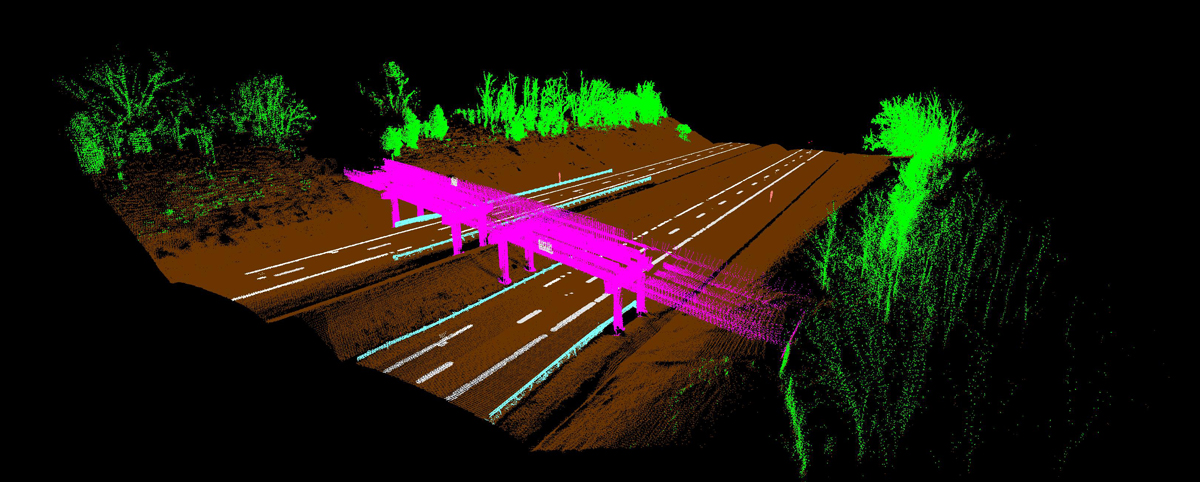
Effective transportation infrastructure asset management starts with understanding your full inventory of assets and their condition. The resulting point clouds from Mobile LiDAR provide a clear picture of your transportation assets and their condition to make data-driven decisions quickly and cost-effectively.

Mobile LiDAR captures roadway and infrastructure assets at posted speed limits, thereby collecting data at a fraction of the time it takes traditional surveying methods.

Mobile LiDAR creates 3D point cloud models that are precise depictions of roadways and infrastructure. These give unparalleled accuracy in establishing relationships between your data points, revealing their true position and condition.

Maximizing the Value of the Point Cloud with PILLAR

PILLAR’s Mobile LiDAR service takes the significance of the point cloud to the next level with its proprietary Fully Automatic Feature Extraction System (AFES) that instantly extracts features and attributes (such as height, width, text, etc.) as data is processed. Machine Learning, AI, and Computer Vision are incorporated in the processing of this data with outputs to standard GIS formats, Shape files, geodatabases, and more.

Gone are the days of spending countless man-hours scrolling through pictures overlapped on the point cloud, pointing a cursor, and clicking on the asset to spatially link the two. Rather than traditional “point and click” semi-automatic extraction, Mobile LiDAR with AFES means fewer days to completion of your global view.

Decisions Backed by Data

Without a global view of your assets and infrastructure, it can be difficult to make decisions for asset managers to justify funding for projects and programs. Tasked with managing hundreds of assets, some organizations are unaware of more hidden assets such as pipelines, drainage systems, and paved ditches. This can account for poorly mismanaged asset maintenance, costing agencies thousands of dollars.

A point cloud analysis powered by PILLAR AFES gives decision-makers the ability to provide asset data across various departments and stakeholders, integrating databases and streamlining processes to cut time and share costs. With a geospatial inventory, transportation agencies can determine priorities and set those priorities with a ROI-focused approach.

Applications for Mobile LiDAR and Point Cloud Analysis

Mobile LiDAR and Point Cloud Analysis help departments of transportation and localities make data-driven decisions to effectively manage the state’s transportation assets. Applications of this technology also serve as a valuable tool for emergency planning, disaster response, and community resiliency in the face of climate change. Infrastructure plays a significant role in these efforts, creating a need to better manage and invest in infrastructure improvements.

With PILLAR’s AFES, data can be instantly extracted and processed as 3D environmental models – increasing efficiency, transparency, and better planning.

An innovative application of Mobile LiDAR with point cloud analysis for mowing management won the Virginia Department of Transportation – Staunton District the Environmental Agency Award. In collaboration with PILLAR, the team discovered it could allocate thousands of mowing acres as stormwater pollutant offsets. The discovery led to a 15,800-pound reduction in nitrogen, saving VDOT about $12.8 million in mitigation projects and nitrogen-credit purchases.

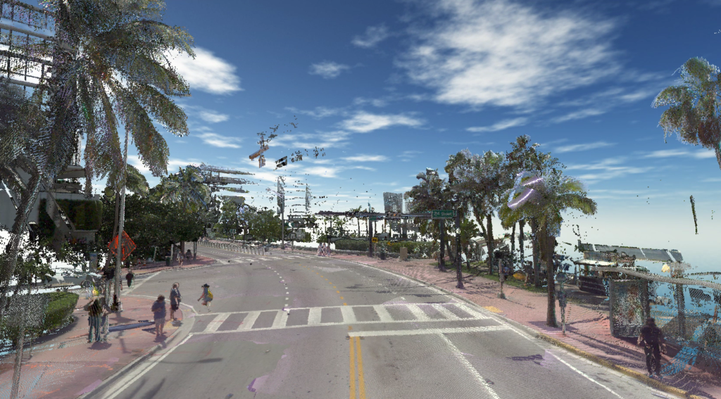
PILLAR Point Cloud Analysis in Miami, Florida

Save Time, Save Money, Save Lives

With the advances in surveying technology like Mobile LiDAR and point cloud analysis, asset management firms can help deploy effective asset management plans that will save time, save money, and save lives. PILLAR is trusted by departments of transportation that manage some of the largest state-maintained highway systems in the country to do exactly that. We help organizations make value-based decisions that proactively manages risk for the long-term needs of your asset base.

Contact us at info@pillaroma.com or (276) 223-0500 to discuss your asset management plans with a PILLAR expert.

Categories
Save Money Save Time

LiDAR-Based Mapping Method for Mowing Management Earns VDOT-Staunton District Environmental Stewardship Award

An innovative application of LiDAR-based mapping for mowing management implemented by the Virginia Department of Transportation -Staunton District is saving the agency millions of dollars annually by converting interstate rights-of-way into pollinator habitats. The innovative program just earned VDOT’s Staunton District the coveted agency’s Environmental Stewardship Award.

VDOT’s Staunton District Roadside Manager Scott Nye and Interstate Maintenance Contract Administrator Guy Tyrrell needed a better way to track vegetation mowing so they collaborated with PILLAR Operations & Maintenance Advisors to develop a solution.

PILLAR worked with Tyrrell and Nye to leverage LiDAR-based mapping and PILLAR’s proprietary automated feature extraction (AFES) software to quickly and efficiently identify VDOT acreage that requires mowing. The approach provides a highly accurate way to measure and track mowing costs and allows quick and easy adjustments to mowing operations. More importantly, the data from the LiDAR mapping method enabled the team to see a  better solution– a large percentage of the interstate rights-of-way could be set aside for pollinator habitats without compromising public safety or roadside aesthetics.

The Staunton District has now allocated more than 5,100 acres of mowing operations to only once per year in the fall. This acreage set aside as meadow can be transplanted into stormwater pollutant “credits” to support the total maximum daily load pollutant reduction requirements VDOT’s MS4 permit. The conversion of mowed turf into a meadow condition equates to a 15,800-pound reduction in nitrogen that would otherwise reach the Chesapeake Bay, saving VDOT about $12.8 million in mitigation projects and nitrogen-credit purchases.

Learn more about how Pillar can work with your DOT or municipality to see the bigger picture and develop cost-efficient transportation asset management solutions.

Categories
Save Face Save Lives Save Money Save Time

Mobile LiDAR Improves Safety By Reducing Need for Work Zones

Transportation surveyors are frequently exposed to significant danger from traffic as they work to collect the asset data required to maintain, build, or repair infrastructure.

The Bureau of Labor Statistics reported that transportation incidents accounted for 76% of roadway work zone fatal occupational injuries between 2011 and 2017. In 60% of these transportation events, the worker was struck by a vehicle in the work zone.

Clearly, roadway operations and maintenance require a safer, accurate, and efficient way to collect infrastructure asset data.

Reducing Traffic Exposure with Mobile LiDAR

A Mobile LiDAR scanning system is the efficient way to inventory transportation assets and their condition at highway speed, eliminating the need for a static work zone that impedes traffic flow as surveying staff conduct their work. Instead, Mobile LiDAR collects data from a vehicle driven at posted speed limits and creates a digital 3-D representation of existing road conditions within the right-of-way.

Mobile LiDAR scans the conditions of infrastructure assets like pavements, guardrails, mowing acreages, bridges, highway signs, and more. Mobile LiDAR takes transportation asset management to the next level, collecting massive amounts of data with speed, precision, and cost-efficiency. Complete surveys in a fraction of the time it takes with traditional survey methods and yield higher quality data for optimal operations and maintenance plans.

Advantages of Mobile LiDAR

  • Easily identify the location of all your transportation assets.
  • Gather robust data while mitigating exposure to dangerous working conditions for employees.
  • Avoid the extra cost and man-hours that come with work zones.
  • Reduced exposure to road accidents and other roadway related injuries.
  • Advanced collection methods ensure accurate asset data and rapid data extraction.
  • Integrate asset data with existing databases and workflows.

Minimize Employee Risk and Maximize Productivity With PILLAR

With advances in surveying technology, the transportation industry is investing in innovative asset management solutions to improve operational efficiencies, optimize budgets, and ensure employee safety in the field.  

As a transportation asset management firm, PILLAR houses advanced technological solutions like Mobile LiDAR, drone aerial collection, street level imagery, and geospatial inventory to locate your assets and identify their condition. Our robust approach to asset management merges technology with specialist expertise to optimize, develop, and execute tailored asset management plans to secure O&M funding and improve the service level of all infrastructure assets.

Partner with PILLAR today and discuss with our experts to figure out the best way to augment your staff safely, reduce traffic interference in your communities, and collect transportation asset data quicker and more accurately than ever before.  

Contact us at info@pillaroma.com or (276) 223-0500 to discuss our Mobile LiDAR solutions and more.