Categories
PILLAR Talk Save Lives Save Time

Solving Congested Rest & Parking Areas for Commercial Drivers

According to the American Trucking Association, there were 3.54 million truck drivers working in American in 2022. That’s a 1.5% increase from 2021. The industry is exploding thanks in no small part to the continuing increase in e-commerce, which has significantly increased demand of delivery services. 

Unfortunately, truck parking capacity has not been able to keep pace with the high industry growth, creating a series of bad days for commercial drivers and their employers.

Trucking’s Parking Problem

The trucking industry has struggled with congested rest and parking areas for commercial drivers for over a decade. The Federal Highway Administration estimates that there are just 300,000 spaces available and many states have closed down rest areas as part of cost-cutting strategies. Drivers themselves often have to sacrifice valuable drive time to find and claim a safe spot, if they can find one.

It’s not uncommon for drivers to enter rest areas only to find that they are completely full. This situation forces them to park in unsafe conditions on the side of busy highways, or drive the wrong way in an effort to leave the full rest area in search of another. 

Asset Management Solutions to Congested Rest Areas

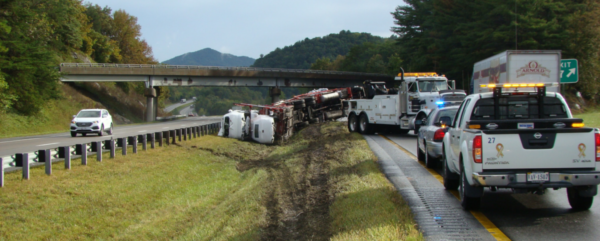
The parking issue for trucking companies is a serious safety and liability issue. Trucks moving against traffic, parked on highway shoulders, or fatigued commercial drivers behind the wheel can cause life-threatening accidents for themselves and other drivers sharing the road.  

PILLAR can help prevent unsafe conditions by implementing an effective mix of technology and thoughtful planning.  

  • Parking Availability Counters: When it comes to rest areas, communication is key. PILLAR can equip rest areas with parking space counters that telegraph the number of available spaces before a truck ever pulls into the lot.
  • Signage: Truckers should never back up or drive against rest area traffic. We work with you to install appropriate signage to guide drivers through a rest area and back onto the highway in accordance with the traffic pattern. 
  • Parking Availability Communication: Good communication can result in good organization. Using weight sensing traffic counters, PILLAR can devise and implement a system of communication that keeps drivers informed while on their routes.
  • Rest Area Reconfiguration: Building new rest areas or even adding additional space for parking spots can be cost prohibitive for some municipalities. We can help make the most efficient use of existing rest area footprint. By reconfiguring the layout of your rest area, we can make more spaces available and mitigate expenses. 

Contact PILLAR and Resolve Congested Rest & Parking Areas for Commercial Drivers

PILLAR is a transportation asset management firm dedicated to maximizing the lifecycle of your assets. Our multidisciplinary team of experts is ready to help you stop bad days before the start through proactive collection, assessment, planning, and execution. Work smarter, not harder with PILLAR. Contact us for help managing your congested rest and parking areas.

Categories
PILLAR Talk Save Lives

Wrong Way Delineation: Techniques and Prevention

Fatalities from wrong-way driving are on the rise. According to the U.S. Department of Transportation, traffic fatalities caused by wrong-way driving accidents increased from 451 in 2016 to 507 in 2020. With the troubling upward trend, more DOTs have begun investigating ways to address wrong-way driving and prevent unnecessary traffic fatalities.

Wrong-Way Driving a Growing Concern

The prevalence of these incidents is a growing concern for DOTS, localities, and law enforcement. For example, Connecticut saw a dramatic uptick in fatal wrong-way crashes, moving from just two in 2020 to 13 in 2023. The CTDOT proactively investigated ways to stop dangerous wrong driving to combat this worrying trend.

The CTDOT determined impaired drivers caused the majority of accidents they faced. They implemented a preemptive plan to keep their motorists safe, including installing extra signage in close proximity to establishments that served alcohol, deploying high-tech electronic signage that warned other drivers of danger, and implementing a real-time alert system for emergency responders.

Wrong-Way Driving Prevention: Techniques, Strategies, and Technology

Prevention measures are key to staying ahead of the risks to keep motorists safe. As the CTDOT has shown, several techniques and emerging technologies can help prevent wrong-way driving and keep motorists safe. 

  • Wrong-way signs: Signage is the classic first step in alerting motorists that they are traveling in the wrong direction. These signs are strategically installed so they catch the eye only of vehicles traveling in the wrong direction, hopefully stopping tragedy before it occurs. 
  • Directional rumble strips: These special rumble strips are designed to activate only if a driver is traveling the wrong way. These directional rumble strips will alert wrong-way drivers through vibration and sound that something is amiss, giving them a chance to stop. 
  • Technology on exit ramps: New technology uses cameras to detect wrong-way drivers and immediately flash bright red LED lights to let them know they are driving the wrong way. Additional technology can notify state police in real-time, dramatically shortening response time. 
  • Variable electronic message signs: These signs protect drivers who are traveling in the correct direction but who are at risk for head-on collisions with wrong-way drivers in their area. When a wrong-way driver is in the area, these electronic signs can immediately warn drivers to beware. 
  • Prioritizing upgrades at high-risk exit ramps: High-risk exit ramps include ramps that are near locations that serve alcohol. Studies found a direct relationship between drinking and driving the wrong way on a divided highway, showing that individuals with BACs greater than or equal to 0.08 g/dL had an odds ratio of 18.36 for driving the wrong way. Prioritizing exit ramps that match these characteristics is of the utmost importance and can decrease the number of wrong-way accidents and fatalities.
  • Reconfigure Rest Areas: Rest areas can be widened, reconfiguring the space to accommodate more drivers and preventing the need for tractor-trailers to move in the wrong direction on a highway.

Make Your Roads Safer with PILLAR

Wrong-way driving often results in head-on collisions with significant injuries or death. Traffic fatalities have devastating ripple effects on families and communities. PILLAR is poised to help your municipality tackle the issue of wrong-way driving through our proven CAPE approach. We can help you collect data to determine the cause of wrong-way driving in your area and then plan and execute a plan that makes your roads safer. 

PILLAR is a trusted partner of DOTs across the country and has a successful record of helping them stop bad days before they start. If you’re ready to address the risks of wrong-way driving in your community, contact PILLAR for a free consultation and see how we can help.

Categories
PILLAR Talk Save Money Save Time

Don’t Let Unpaid Third-Party Damage Claims Cause a Bad Day.  
PILLAR Can Help.

Let’s face it, traffic accidents cause bad days for all involved. Unfortunately, for transportation asset managers getting the damage repaired is often just the beginning of the bad day saga. Collecting third-party damage claims from a driver’s insurance company is critical to getting funds you need. If not dealt with quickly and thoroughly, DOTs can lose millions in claims that they’re owed. But navigating the complicated collection process is time consuming and frustrating. 

Get the insurance money you’re owed. 

Don’t miss out on insurance recovery claims on damaged assets. PILLAR can help with a team of multi-disciplined professionals who take the complexities out of the collection process. We will work to identify the damage, investigate the circumstances and help you build a claim package that’s ready to submit. 

Our work speaks for itself. PILLAR’s has helped one DOT collect over $4.5 million in third-party damage claims over the past five years.

PILLAR Helps You Save Valuable Time and Money 

With PILLAR, you can identify and investigate damages faster and more efficiently. You’ll see significantly higher collection rates, which frees up budget for transportation management initiatives. We put in the work to identify and investigate damages and put together a claim package to save you time and money.

We can help clients identify asset damage in a number of ways, including our connected infrastructure sensors which provide alerts when there is an impact or other issue, our team in the field sites a problem, or we are alerted by the DOT to send our team out. 

Then, PILLAR’s professionals begin gathering information in the field — everything from the time, date, location and photographs of the damage to the names and contact information of the law enforcement officers who responded after the damage was done. With decades of experience across the realm of transportation, our team has the experience to know that the more information we can collect from the scene, the better for the DOT. 

PILLAR generates an estimate of the damages, collects copies of the law enforcement reports through your state’s Department of Motor Vehicle system, and then compiles everything into a claims package for a DOT’s district accounting specialist for processing and collection.

No More Guesswork on Third-Party Damage Claims

Stop your bad days before they start. With PILLAR you will have the peace of mind that your damage claims are being managed proactively by a seasoned team of experts using the latest technology. 

Rely on our expertise to remove all the guesswork from the collection process.

Contact Us Today

Don’t let your damage collection process get bogged down in paperwork. Book a discovery meeting with PILLAR to learn more about how we can help you identify damage, investigate the circumstances, and build a case, making it easier to collect what you’re owed.

Categories
PILLAR Talk Save Money Save Time

The 2022 Infrastructure Law: Positioning Your Shovel-Ready
Transportation Project for Success

The 2022 Bipartisan Infrastructure Law addresses long-needed funding to state and local governments for thousands of “shovel-ready” transportation infrastructure improvement projects in all 50 states, D.C., and Puerto Rico. Over a period of five years, the law provides an unprecedented investment of $350 billion in highway programs for state and local governments to tackle long-overdue improvements to infrastructure.

The Bipartisan Infrastructure Law is the largest investment in roads and bridges since President Eisenhower’s investment in the interstate highway system. While the law offers an exceptional amount of funding, competition is fierce. Keep reading for tips on how to present your shovel-ready transportation projects and successfully apply for funding for your state or locality.

What are Shovel Ready Projects?

Today, “shovel-ready” describes a transportation project that has fully completed planning, has necessary permits, and approvals in hand, and is ready to put people to work right away once funding is in place. If you’re interested in applying for funding through the 2022 Infrastructure Bill, it’s important to pick the right project to stand out in the application process while maintaining realistic goals for your current workflow.

How to Prepare for a Shovel-Ready Project

Construction never happens on a wing and a prayer. As any infrastructure professional knows, construction projects require careful planning, preparation, testing, and permitting long before gaining clearance to break ground. Doing the prep work prior to funding helps you stay prepared to seize opportunities when they arise. 

  1. Review the Project Priority List in Your Region: Identify priority projects for your region that align with the stated goals of the Bipartisan Infrastructure Deal. According to the White House, the goals of the deal are to, “rebuild America’s roads, bridges and rails, expand access to clean drinking water, ensure every American has access to high-speed internet, tackle the climate crisis, advance environmental justice, and invest in communities that have too often been left behind.” 
  2. Evaluate what steps are needed to qualify for shovel-ready status: Once you’ve identified a list of potential projects, it’s important to be realistic about which are closest to being shovel-ready.  Do any of the projects already have planning and regulatory compliance completed? If none of your projects are quite at the shovel-ready stage, try to find a project that would allow you to complete all the steps to getting shovel-ready in time to apply for funding. 
  3. Identify which type of funding is right for your project. The funding included in the Bipartisan Infrastructure Law is broken out into different types of programs and grants. Review their list of grant programs carefully to find which grant your project best qualifies for. This will increase your chances for successful funding. 
  4. Prepare your best proposal. You’ve done the difficult work of planning. Now it’s time to write your proposal. Gather all your data, paperwork, and permits, and start building a case for your project. 

PILLAR Can Help Get Your Projects Shovel-Ready

These steps seem straightforward but can be close to impossible for DOTs and organizations that are already stretched thin when it comes to time, resources, and manpower. That’s where PILLAR can help. We’re fully equipped to help you get your project to shovel-ready status, from start to finish.  We even have full-time proposal writers who have a track record of success.  They can devote time and expertise to help you get the funding you need. 

We are a trusted advisory partner that DOTs, municipalities, and P3 stakeholders rely on for fiscally responsible operations and maintenance. PILLAR can act as an extension of your agency, providing full-time expertise without the full-time price tag. From boots on the ground to technical writing, PILLAR’s combination of expertise and integrity has got you covered. Contact us to find out how we can get your projects shovel-ready today.

Categories
PILLAR Talk Save Face Save Lives Save Money Save Time

Benefits of Proactive Culvert Cleaning

As summer heats up, so do thunderstorms. This can mean sudden inundation of heavy rain, increasing the risk of dangerous flooding for your assets. Flooding is a serious issue that is exacerbated by blocked culverts which can cause road collapse resulting in trapped residents at best and loss of life at worst. To stay ahead of the game, a proactive culvert condition assessment and cleaning plan helps prevent dangerous roadway flooding.

Reactive Culvert Cleaning Has a High Price Tag

Culverts can be difficult to access, making it easy to put off regularly assessing their condition. Unfortunately, with this approach asset managers only become aware of blocked culverts when a storm rolls in. By then it’s too late to prevent dangerous flooding or road collapse.

Addressing emergencies is paramount but that doesn’t mean that it isn’t challenging. Multiple high-stakes events can quickly exhaust staff, equipment, and budgets. Tasks get backlogged and expenses can mount including:

  • Labor costs in the form of wages and benefits for the crew members who work on the emergency mobilization.
  • Equipment costs such as renting or deploying any necessary equipment like excavators, dump trucks, or bulldozers.
  • Transportation costs include transporting the crew and equipment to the job site.
  • Overtime pay can be a factor if the emergency mobilization requires work outside of normal business hours.
  • Permits and fees might be required to carry out the emergency mobilization.
  • Material costs can include any materials needed for the job such as sand, gravel, or concrete.

Proactive Culvert Cleaning Saves Time, Money, and Lives

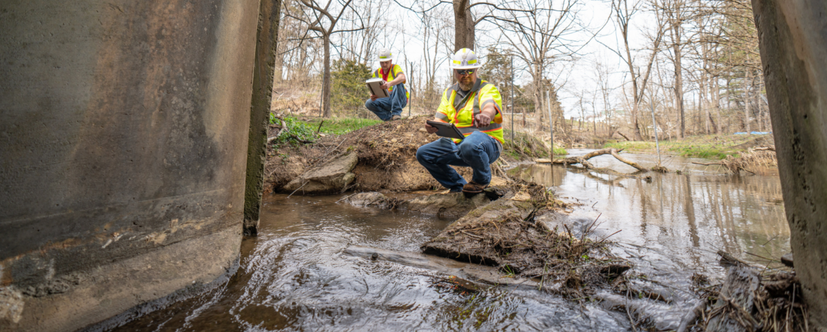
For years, PILLAR has helped municipalities and DOTs manage assets.  In addition to our planning and execution expertise, we have tools that makes it easy to collect geospatial data in underground assets. We deploy the DeepTrekker 240 L Pipe Crawler robot to safely and efficiently identify culvert conditions and possible flaws. It’s portable, submersible, and can access areas that are difficult or unsafe for humans to enter.  Its rugged design and camera with full functionality give you complete control of your data collection and assessment.

When you combine this tool with a management plan created specifically for culverts in your service area, you’ll have a proactive plan that allows you to schedule crews to maintain culverts regular hours in good weather. You’ll likely experience less flooding and safer roadways too.

This planned approach saves you time and money because you’ll have less backlogged tasks and unplanned expense related to crisis management. And your team will love the culture of sustainability that develops as a result.

Contact PILLAR

Creating a proactive plan for your transportation assets doesn’t have to be overwhelming. With our decades of combined experience, PILLAR can help you stay in front of potential emergencies like clogged culverts. Book a discovery meeting with PILLAR to learn more about how we can help you develop a systematic solution for your transportation infrastructure.

Categories
PILLAR Talk Save Money Save Time

How Knowing Your Mowing Acreage Helps You Avoid Cost Increases

If you use mowing contractors, you may be familiar with the incremental “bump” in acres/prices that happens as they spend more time, labor, and resources to fulfill their mowing duties. That’s because often contractors accidentally begin mowing more and more areas. This scope creep is unintentional; sometimes, it’s just a normal byproduct of the job and it happens more frequently when there’s a lack of clear acreage guidelines. 

To help contractors stay on track it’s important to regularly assess your mowing acreage. It may seem like a small detail but being clear about how much acreage you’re responsible to mow can save you millions.  

How PILLAR Calculates & Classifies Mowable Area 

PILLAR specializes in providing rapid and accurate data collection and assessment so you always have the most up-to-date information about your transportation assets.  

When you work with us, you’ll benefit from Mobile LiDAR (Light Detection and Ranging), a powerful mapping method. Mobile LiDAR uses laser scanning to accurately identify roadway assets and related infrastructure at highway speeds. Typically, LiDAR captures data for hundreds of miles of right-of-way a day, making it the ideal solution for use in asset management, geospatial (GIS), and surveying and mapping. Plus, our mobile LiDAR service includes a fully automatic feature extraction system that saves up to 10-fold the time and cost of traditional “point and click” semi-automatic extraction methods.  

With PILLAR, it’s easy to regularly assess your mowing acreage so you can keep your organization on track. 

PILLAR Goes the Extra Mile So You Don’t Have To 

We don’t stop at data collection and extraction. Our services also include an assessment of the terrain you’re responsible to maintain so you can know with certainty:  

  1. the types of equipment you need.  
  1. the time and frequency required to maintain your acreage.  

The information we gather helps us configure the most efficient mowing patterns for full mows or partial mows. We also leverage our knowledge of stormwater regulations to determine if you can earn environmental stipends for mowing less frequently. 

After all the data is collected, we will work with your geospatial system of choice to integrate and normalize your mowing data. The resulting enhanced database keeps your mowing contractors informed with complete and interconnected information. 

Contact PILLAR 

The PILLAR team has more than 100 years of combined experience working with and for municipalities and departments of transportation. Our clients trust our cutting-edge methods and results. Learn how we can help you avoid mowing scope creep to save time and money. Contact us today. 

Categories
PILLAR Talk Save Money Save Time

How Proactive Ditch Cleaning Mitigates Emergency Mobilization

As an asset manager, you know how hard it can be to stay in front of potential emergencies. Asset management is a complex, ever-changing landscape and part of the job involves responding to unforeseen events.

However, many asset managers report that 80% of their job is dealing with crisis and only 20% is devoted to planning. With the right support, it’s possible to flip that ratio so you spend less time and money reacting to crisis. Taking a proactive approach to your asset management makes a huge impact on team morale, stress levels, and your bottom line.

How Reactive Ditch Cleaning Hurts Business Outcomes

Most people overlook the important role ditches play in keeping roads safe and usable. Until, that is, a storm rolls in and the ditch is clogged or blocked. Roads (and even homes) can become rapidly flooded, making them impassible and creating an emergency.

Emergencies like this can happen at any time of day or night regardless of whether you have enough staff, equipment, and time available. Gathering your resources and reacting in a timely fashion can be exhausting and expensive. When you’re stuck reacting to emergencies, costs can easily skyrocket. Expenses can include:

  • Labor costs in the form of wages and benefits for the crew members who work on the emergency mobilization.
  • Equipment costs such as renting or deploying any necessary equipment like excavators, dump trucks, or bulldozers.
  • Transportation costs include transporting the crew and equipment to the job site.
  • Overtime pay can be a factor if the emergency mobilization requires work outside of normal business hours.
  • Permits and fees might be required to carry out the emergency mobilization.
  • Material costs can include any materials needed for the job such as sand, gravel, or concrete.

How Proactive Ditch Cleaning Improves Business Outcomes

Contrast this with a thorough assessment and management plan created specifically for the ditches in your service area. Instead of mobilizing crew and equipment after a clogged ditch becomes a problem, generate a list of clogged or at risk ditches during regular inspection. Then, schedule crews to clean them in order of severity during regular hours during good weather.

This proactive, planned approach will save you time and money. You’ll find that you backlog less tasks, avoid unplanned expenses related to crisis management, and create a culture of stability for your team.

Utilize Pillar’s CAPE Method for Maximum Results

Pillar specializes in data collection, assessment, planning and execution through our proven CAPE method. With Pillar on your side, you can have powerful data to create a systematic planning and management program, be intentional about your asset management, and take control.

Stay in front of potential emergencies with solid planning and execution. Book a discovery meeting with PILLAR to learn more about how we can help you develop a systematic solution for your transportation infrastructure.

Categories
PILLAR Talk Save Face Save Lives

The Road to Zero Fatalities in 2023

National Transportation Safety Board Chair Jennifer Homendy cast a vision of zero fatalities as the standard metric by which transportation safety is measured during her keynote speech at this year’s Transportation Research Board (TRB) Annual Meeting 

“Plenty of people think that zero deaths is an unrealistic goal,” Ms. Homendy noted. But she pointed out that any transportation fatality is a tragedy. “We must care about the safety of strangers…because it’s the right thing to do.”  

Steps Toward Zero Fatalities  

Ms. Homendy’s stirring speech inspired transportation industry professionals to consider the ways in which they could work toward the goal of zero fatalities within their area of responsibility. While advances in technology and equipment have created great leaps in highway safety, it’s often the routine maintenance tasks that make the difference. These tasks can include: 

  • Ensuring assets are in a state of good repair. 
  • Installing guardrails properly and inspecting them regularly. 
  • Installing wrong way detection devices. 
  • Maintaining markings for all lanes (vehicle and bike/pedestrian) keeping them bright and vibrant. 
  • Replacing faded or illegible signs and ensuring they are retroreflective. 
  • Repairing damaged pavement and staying ahead of potholes. 
  • Keeping drains open to prevent back up and reduce the possibility of flooding.  

The tasks are straightforward, but they are rarely simple. Transportation asset management is a complex job with an ever-changing set of demands. Creating and executing a regular maintenance schedule is more difficult than it sounds. And that’s where Pillar can help. 

How Pillar Can Help You Keep Roads Safe 

PILLAR is an asset management firm comprised of multidisciplined professionals with decades of tactical, strategic, and operational experts who are ethically committed to the well-being and safety of the public.  

We deploy our proven CAPE method for every client to help them avoid pitfalls and overextended budgets. Through collection, assessment, planning, and execution, they have powerful data to create a systematic planning and management program, be intentional about their asset management, and reduce fatalities on the road. Here’s how it works: 

Collection: PILLAR’s collection process combines cutting-edge technology with time-proven approaches. We will collect all existing and new data and normalize it with the tools you’re already using. 

Assessment: Using a combination of modern technology and hands-on field experience, we can accurately evaluate the condition of your assets. 

Planning: We can help with asset management planning. Our data-driven strategies clearly address your assets’ maintenance needs to help you secure necessary funding and close the skill gap for your company. 

Execution: PILLAR’s execution process uses the best-equipped Operations and Maintenance managers to help reduce skill gaps, address public concerns, handle financial adversity, manage and monitor contractors, inspect jobs, and adjust existing plans. 

Contact Us 

Ms. Homendy emphasized, “Safety, especially when it comes to new policies new transportation policies and new technologies whether it’s on our roads in the air or anywhere throughout our transportation system, cannot be overlooked ever.”  

We couldn’t agree more. Contact us today to see how we can help you work toward the goal of zero fatalities in your transportation infrastructure. 

Categories
PILLAR Talk Save Money Save Time

Are You Getting What You Ask for in Your LiDAR RFP?

If it’s too good to be true, it probably is.

Beware of any proposal that doesn’t spell out target accuracy requirement details and is coupled with a lower price. You may be left with inaccurate data that will cost you much more down the road, opening you up to costly change orders. A responsive and responsible bidder will always clearly spell out how they plan to meet target accuracy requirements so you can make an informed decision.

Many bidders will try to confuse proposal reviewers and prey on their lack of technical training. They take advantage of reviewers who aren’t familiar with the difference between RTK/PPK correction or absolute accuracy and relative accuracy. By using a lot of buzzwords and citing equipment accuracy tolerances, they hope to convince you that a surveyor, validation/check, and control points aren’t necessary to prove accuracy. You may read the proposal and believe that utilizing a scanning vehicle equipped with an IMU, GNSS, wheel encoders and a DMI to prevent drift and self-correct will be within accuracy requirements.

Sometimes you want the data accurate down to the inch and sometimes positioning within a few feet is acceptable enough for crews to locate an object in the field. Today’s mobile LiDAR equipment is powerful and allows us to do amazing things when it comes to location and accuracy. However, any specified accuracy still needs to be checked or verified.

How to Think About Point Cloud Accuracy

Imagine you walk into a dark warehouse (Point A) and need to get to a door on the other side (Point B). If the lights were on, this would be a simple task. You can see where you’re going and walk toward the door. With the lights out, the task becomes more complicated. You’ll likely unintentionally drift off course between Point A and Point B. When you get to the other side, you’d be unable to report how straight your path was let alone if you are even at the door, until you turn on the lights and adjust your position to the door.

Now imagine you’re in the same dark warehouse, but now you have familiar objects like a table, chair, or desk you can tap as you pass by. You’re much likelier to find the door by checking your position as you go. This method allows you to correct your course along the way and ensures that you actually are where you think you are.

Now imagine you’re in the dark warehouse with a dusty floor and your familiar objects, but also notches in the floor every so often marking the path. You get to the other end, turn on the lights and can see the path you took. The notches on the floor allow you to measure the distance between your footprints and your target path to check your accuracy and validate how close you were to following the path. Without those notches in the floor, you can’t validate your accuracy because you have nothing to measure against to verify or validate specified tolerances.

This is why it is necessary to tie mobile LiDAR scans to surveyed control points when a target accuracy is specified. Control points make it possible to correct positioning and adjust the recorded course to match the real-world course, just as tapping a known object as you walk through the darkened warehouse allows you to adjust your trajectory to the door. Furthermore, validation points allow you to verify that your data falls within the specified accuracy threshold. Without validation, asserting that the data is accurate would be impossible.

Applying surveyed control and validation points to your mobile LiDAR data is like walking across the darkened warehouse, with your path lit by tiny lights that guide your way. You may not be able to see your entire environment, but you have enough reliable information to arrive at your goal.

Poor GNSS Signal and Accuracy Challenges

Absolute Accuracy vs. Relative Accuracy are must-know terms for anyone evaluating an RFP.

  • Absolute accuracy refers to whether or not objects in the point cloud fall near their actual location in the real world. This is sometimes referred to as “accuracy.”
  • Relative accuracy refers to whether or not objects within the same point cloud lie in true positions relative to one another and if the object occupies the same location in multiple passes. This is sometimes referred to as “precision.”

Ideally, data should be both accurate and precise. To achieve this, professionals often use RTK (real-time kinematic) and PPK (post-processed kinematic) technologies to correct raw GPS data and achieve centimeter-level positional accuracy. However, this technology is contingent on a strong signal at the site from one or more GNSS constellations, as this raw satellite data forms the basis of your data corrections.

Professionals commonly utilize data from base station networks like CORS (Continuously Operating Reference Stations), operated by NOAA, or from subscription base station networks to perform RTK/PPK corrections. These networks are comprised of base stations situated atop points of known position and/or elevation. These base stations monitor GNSS signals from various constellations to:

  1. determine how inaccurate the GNSS calculated position is and
  2. determine an appropriate correction.

This correction can then be applied to your mobile LiDAR trajectory within a reasonable distance of the base station. Thus, an RTK/PPK corrected position will be more accurate than the raw GNSS calculated position. However, these corrections only apply to data received from the GNSS satellite constellations. They offer no benefit in situations where the GNSS signal is significantly blocked, as is the case in heavy canopy, urban canyons, or any area with a significant portion of the sky obscured.

It should be noted that, with respect to mobile LiDAR scans, these corrections alone are not sufficient to claim any particular accuracy. Additional steps are therefore necessary in order to validate and report the accuracy of the resulting point cloud.

Trajectory, Control, and Validation of Your Point Cloud Data

The three warehouse examples emphasize the three phases of point cloud data location and accuracy that are easy to confuse.

  1. PPK/RTK corrections from base station data (i.e. CORS). This phase helps correct errors in the position based on the GNSS signal and are provided by base stations operated from known locations. These stations don’t actually have to be within the survey area, just within a reasonable distance (usually a couple dozen kilometers, though this is dependent on terrain and other field conditions). This correlates to the first warehouse example where you need to correct errors in your overall path as a whole (trajectory).
  2. Control Points. These are surveyed points within the data collection area that are visible in the data and can thus be used to anchor the data to a known datum. In other words, they are used to adjust the data to its correct real-world position. Control points will help correct errors arising from the local environment or the mobile LiDAR scanning unit itself. This correlates to the second warehouse example where you are touching objects as you move through the warehouse. It’s useful in cases where you need to correct errors from the ground within the bigger picture and tie it to the ground.
  3. Check Points. These are surveyed points within the data collection area that are visible in the data, but they are not used to adjust the data, only to measure the offset of the location of the data to its real-world position. Check points are for reporting accuracy and verifying the data. This correlates to the third warehouse example where you have notches in the floor (i.e., a known real-world position) and are comparing them against the footprints on the dusty floor tracking your location (point cloud position). This validates that all remaining errors are within acceptable limits.

How does this all work and interrelate? #1 is frequently used on its own if there is no accuracy requirement. If there is an accuracy requirement, the only way to prove that the requirement has been met is with #3. However, there’s a good chance that in areas of poor GNSS reception (heavy tree canopy or blocking mountain faces), #1 will not be sufficient to meet accuracy requirements, so #2 would need to be used in those areas as well. It wouldn’t ever make sense to use #2 without #3, because #2 takes a lot of effort and you would certainly want to prove that #2 has worked. An important note, no single point should ever be used as both #2 and #3.

Work with a Responsive and Responsible Bidder

Some bidders may assert that you don’t need to set control points or validation points and can save lots of money. The problem is that by doing this, they aren’t responding to your accuracy requirements and therefore are not a responsive and responsible bidder. No accuracy can be demonstrated without a comparison to known, real-world positions (validation points).

A solid proposal will tell you the number of validation points it will take to verify that your data meets accuracy and how and where these points—and any necessary control points—will be established.

PILLAR prides itself on our commitment to quality and accuracy. We utilize cutting-edge technology, including mobile LiDAR, alongside over a century’s worth of combined expertise to be a partner you can rely on. Contact PILLAR today to learn more about how we can assist you with your next project.
Categories
PILLAR Talk Save Face Save Lives

Are Your Guardrails Potentially Deadly? Here’s How to Fix It

Guardrails are meant to keep drivers safe on the highways, but improper installation practices make guardrails yet another life-threatening hazard for motorists. 

What are Frankensteined Guardrails?

In the spring of 2020, high school senior Isabella Alonzo was killed after crashing into a guardrail on a Georgia highway. Instead of cushioning the impact, the ‘Frankensteined’ guardrail impaled her car. Like the famous monster, the guardrail was assembled from parts made by different manufacturers.

Frankensteined guardrails occur when a guardrail and a terminal are mixed-and-matched. This practice is against federal guidelines because guardrails are engineered to collapse on impact. When guardrails are piecemealed together from disparate parts, the guardrail may not collapse and instead pierce a vehicle moving at highway speeds.

How to Correct Frankensteined Guardrails

The first step in correcting Frankensteined guardrails is to conduct an inspection of all the guardrails in your asset inventory. These guardrails may be difficult to spot for the untrained eye, but experts have no trouble identifying the potential dangers. For example, PILLAR’s guardrail experts are familiar with installation practices of various types of guardrail systems and can quickly and easily identify Frankensteined or damaged guardrails.

You may consider engaging an infrastructure asset management firm with technological capabilities to conduct a thorough inspection of all your guardrails. At PILLAR, we’re equipped to handle the most complex data collection. Not only can PILLAR perform a manual survey, but we can also leverage data collection from the air through our mobile LiDAR, spherical images, and point cloud technology. This comprehensive method is quick, efficient and prevents dangerous guardrails from being overlooked.

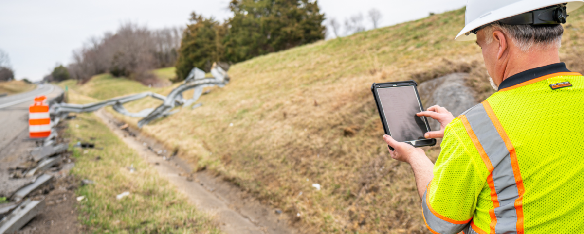
It is imperative to correct any Frankensteined guardrails as soon as possible to prevent unnecessary loss of life. If your current roadside crew is stretched thin, PILLAR provides boots-on-the-ground support to rapidly address safety issues, keep you in compliance with federal guidelines, and reduce the danger to motorists.

Contact PILLAR

Frankensteined guardrails pose a deadly threat to the public, but PILLAR can help. We are a firm of multidisciplined professionals with decades of tactical, strategic, and operational experts who are ethically committed to the well-being and safety of the public. From data collection to staff augmentation PILLAR can help optimize your asset management. Our team of experts is eager to speak with you; contact us today!